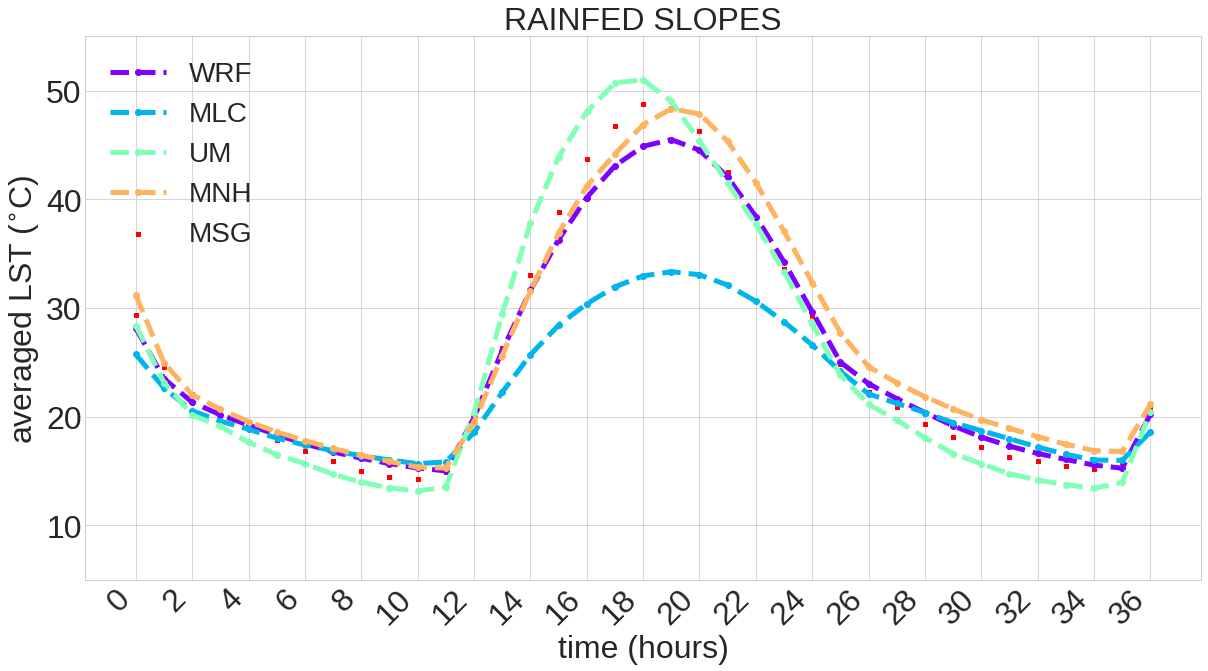
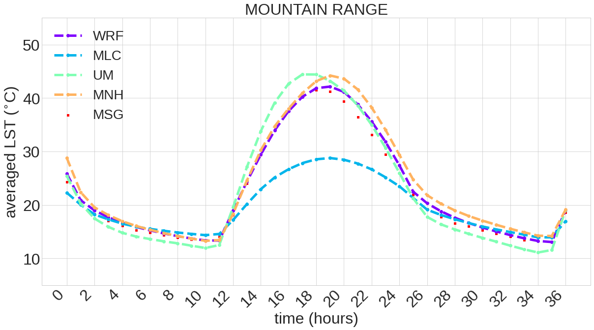
MNH: MesoNH , MLC: Moloch, UM: Unified Model , WRF
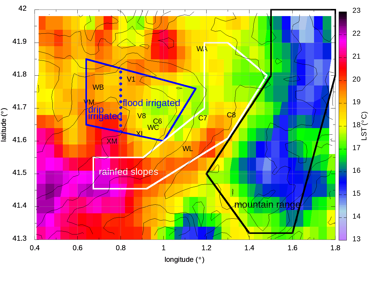
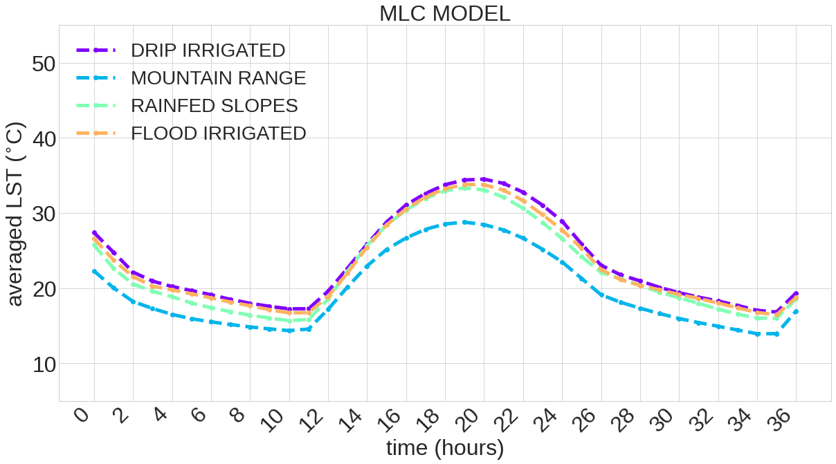
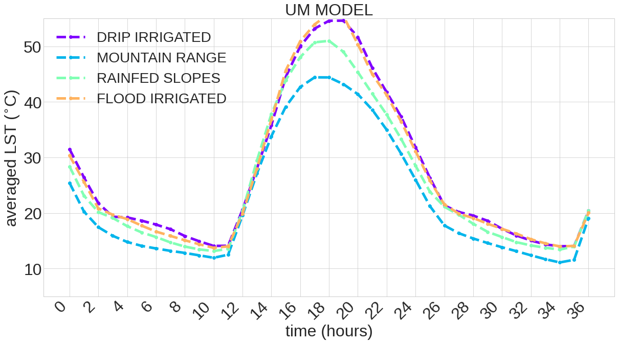
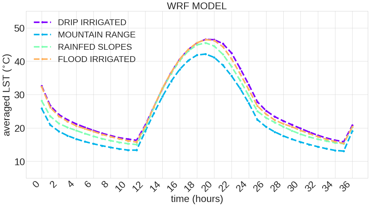
1A. Comparing LST for different zones
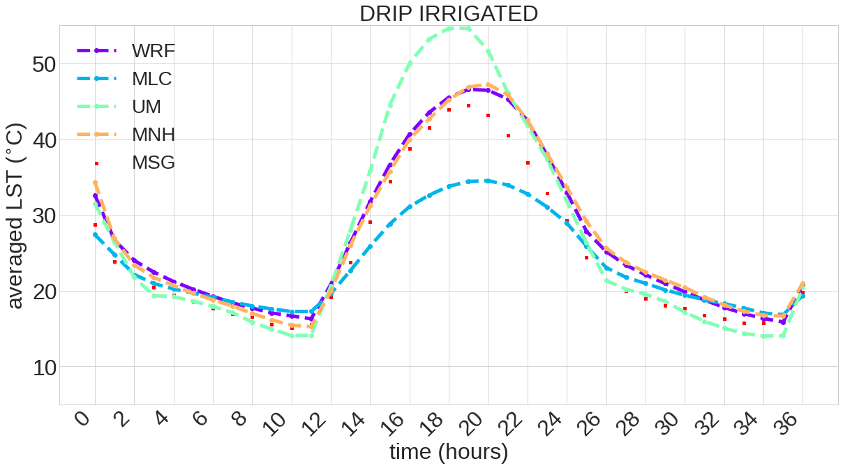
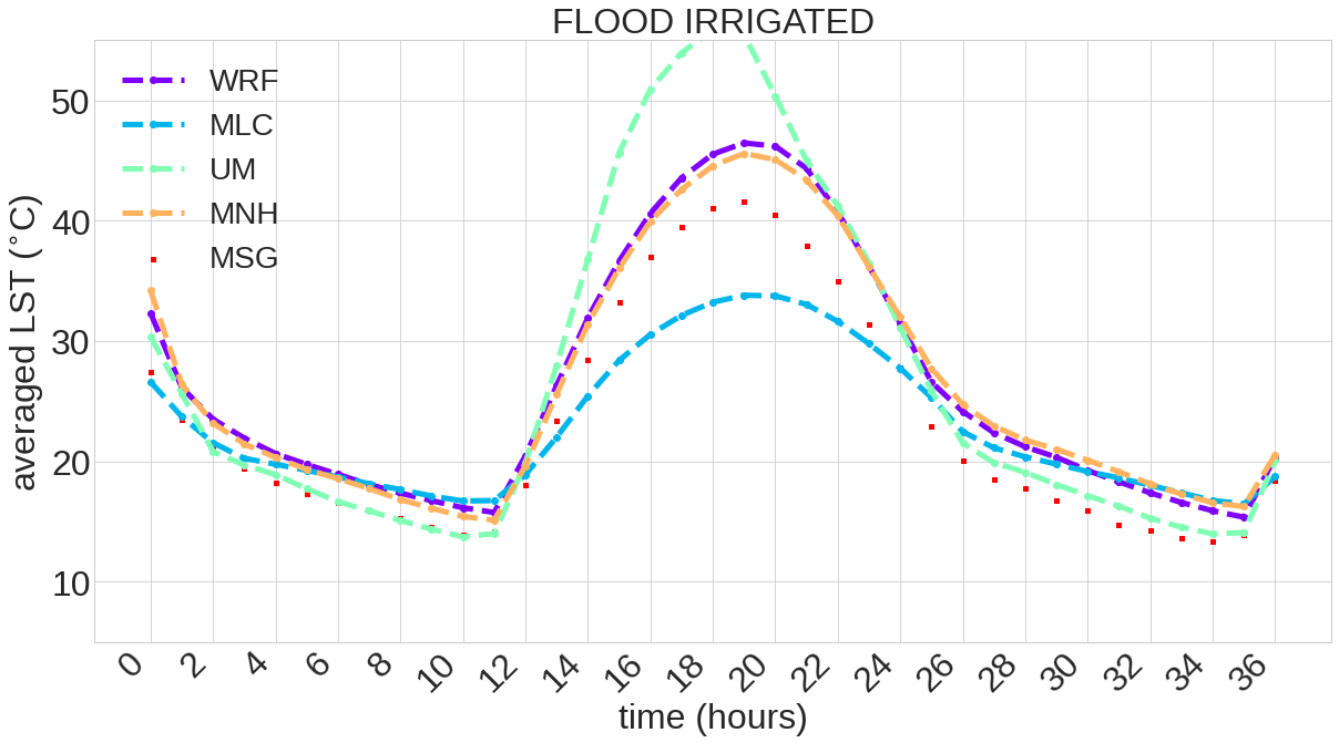
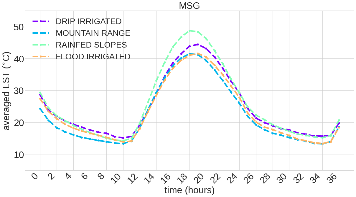
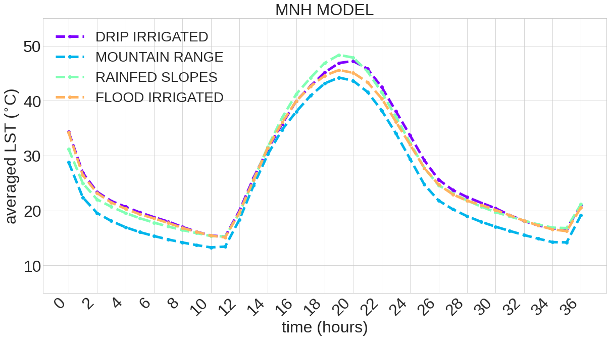
1B. Comparing LST for each model and MSG
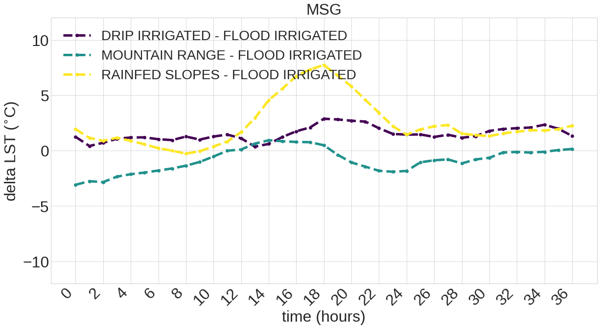
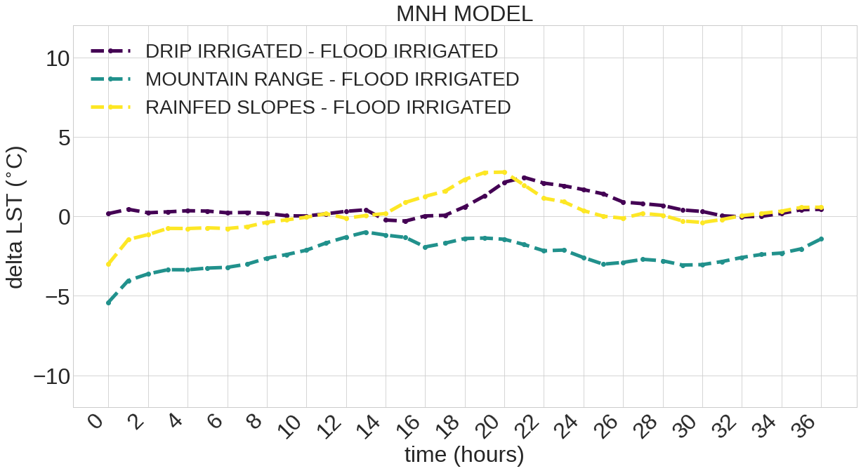
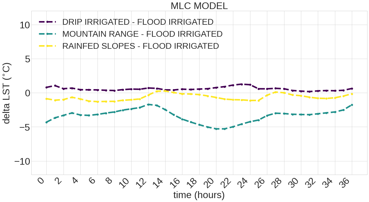
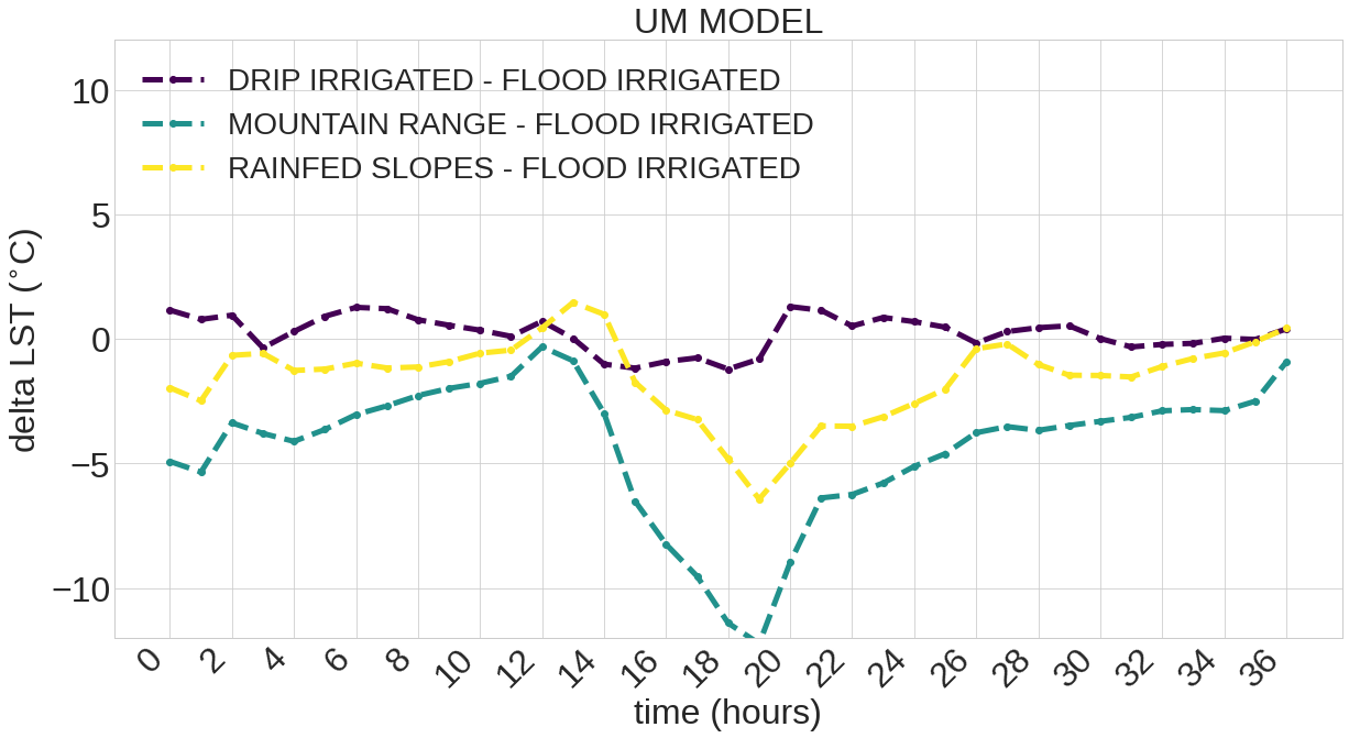
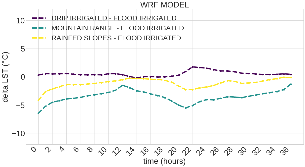
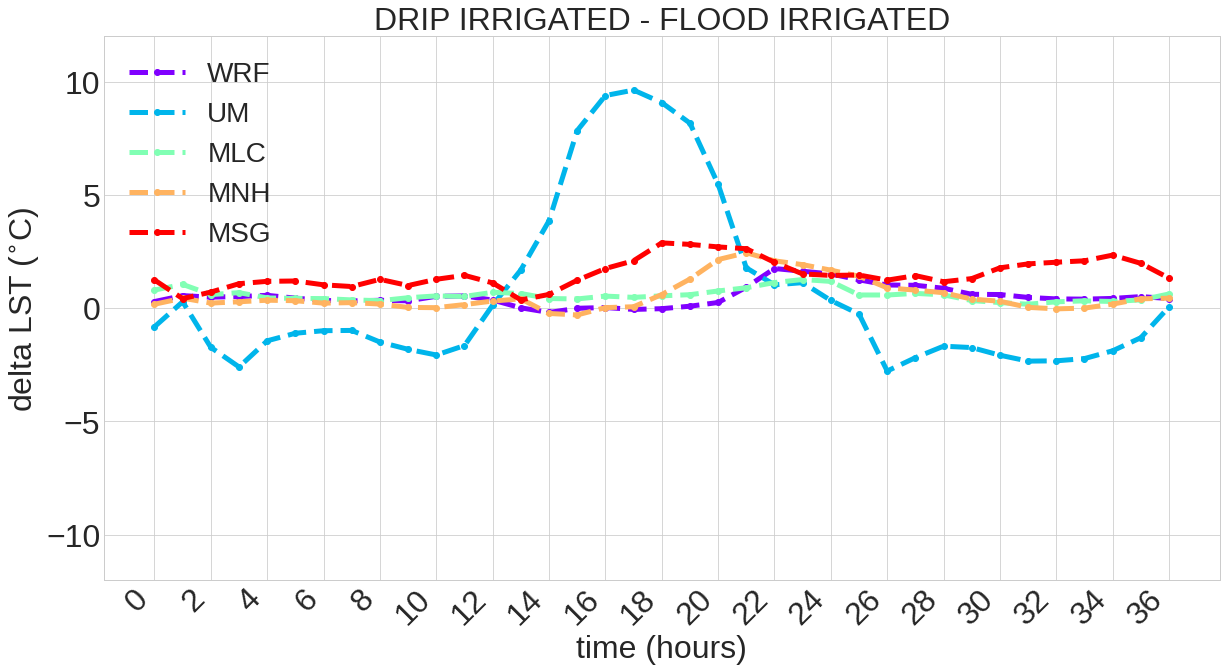
2A. Comparing the temperature gradient among different zones (taking as the reference the flood irrigated region)
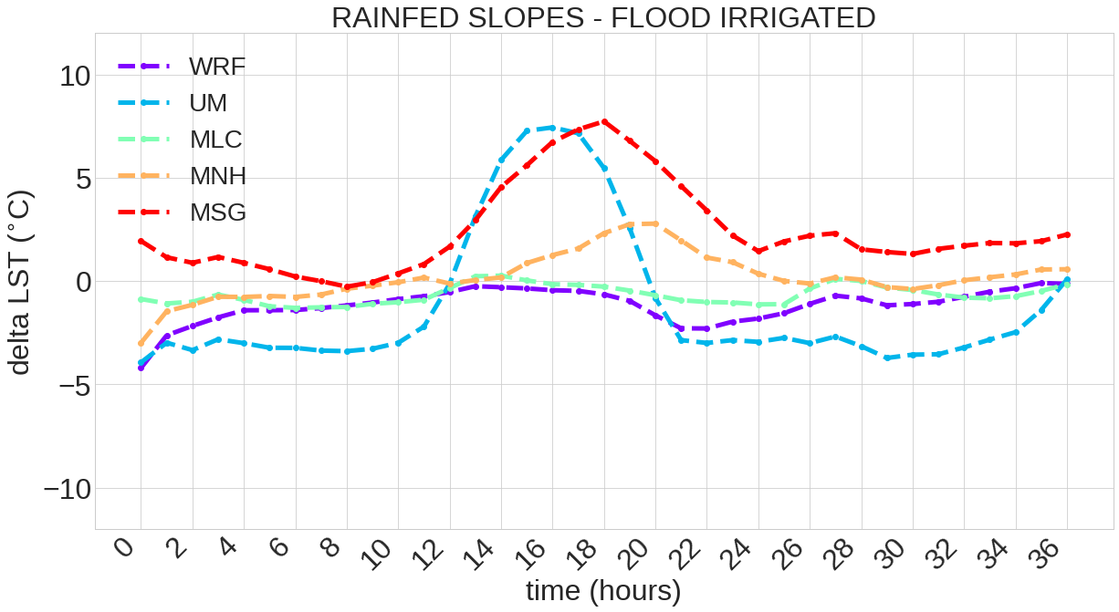
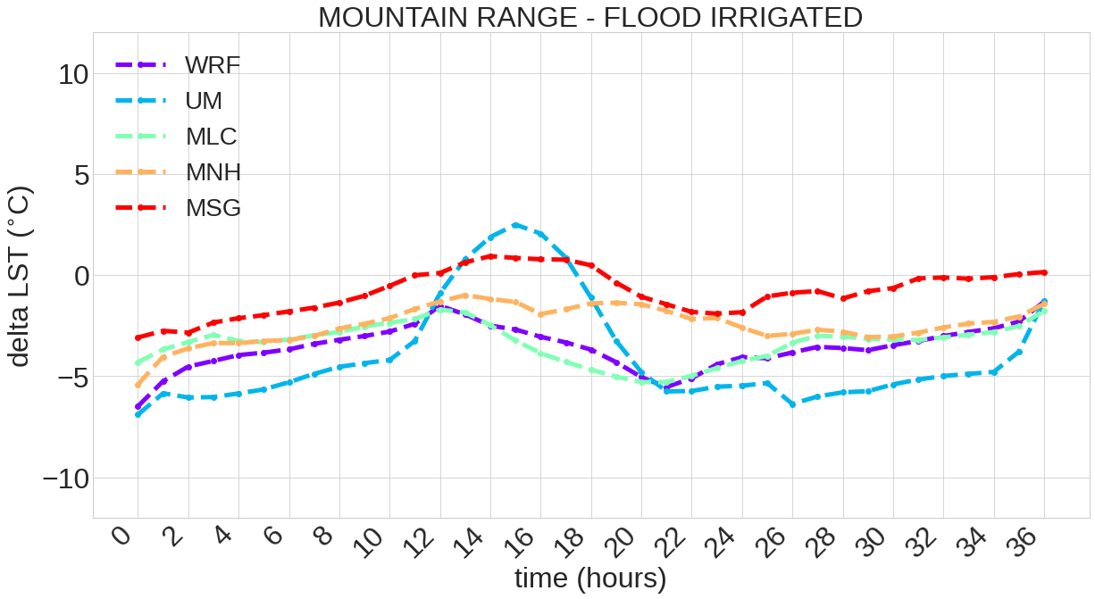
2B. Comparing the temperature gradient for each model and MSG (taking as the reference the flood irrigated region):