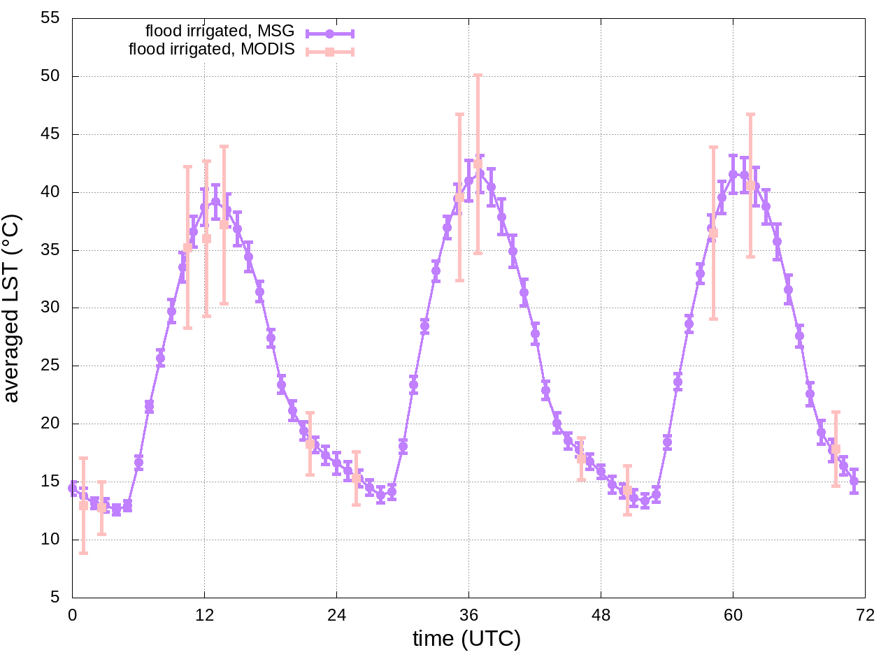
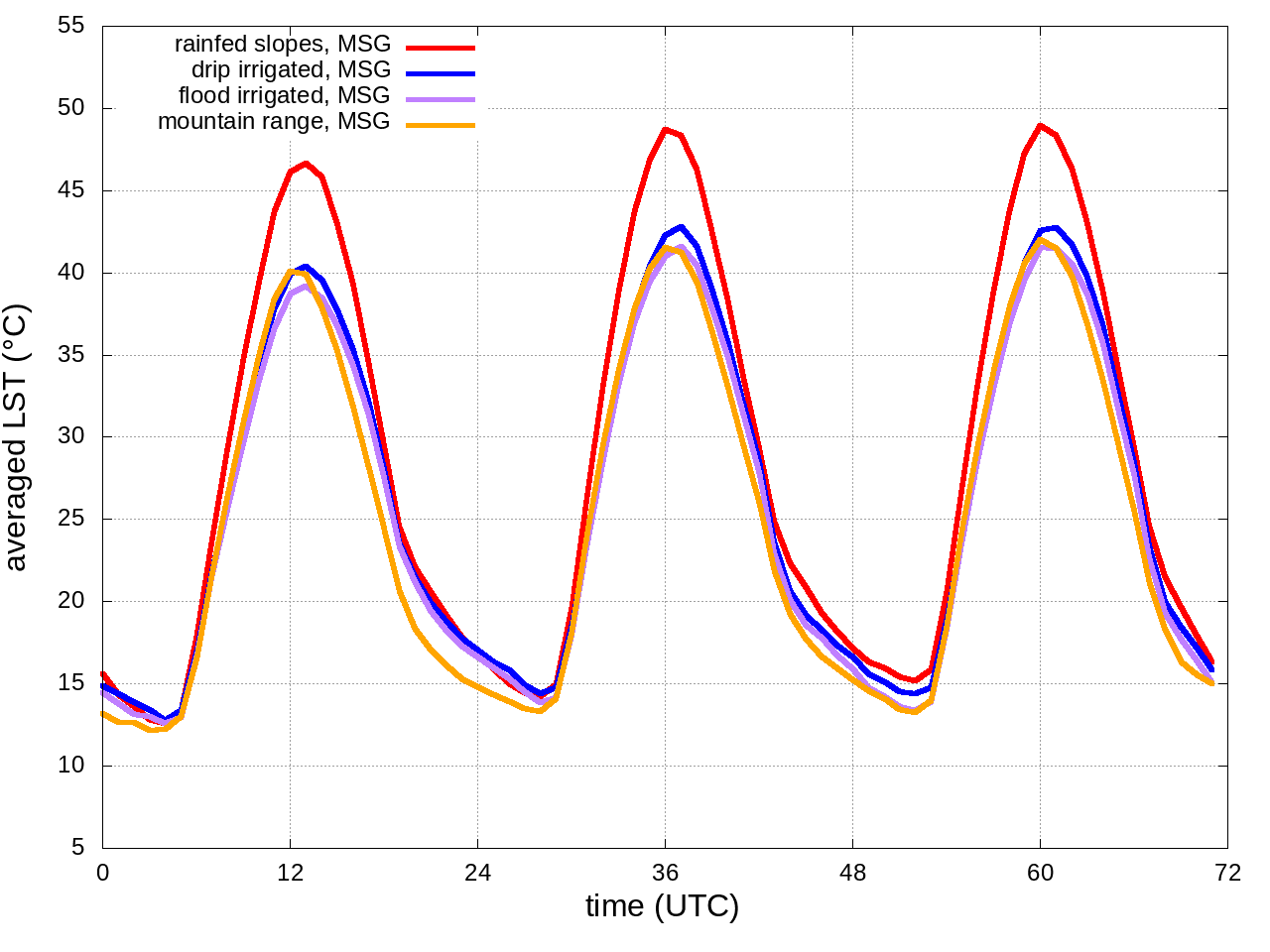
LST fields (hourly for MSG and at some instants for MODIS) are averaged over four regions:
drip irrigated (WEST side, blue polygon),
flood irrigated (EAST side, blue polygon),
rainfed slopes (white polygon) and
mountain range (black polygon).
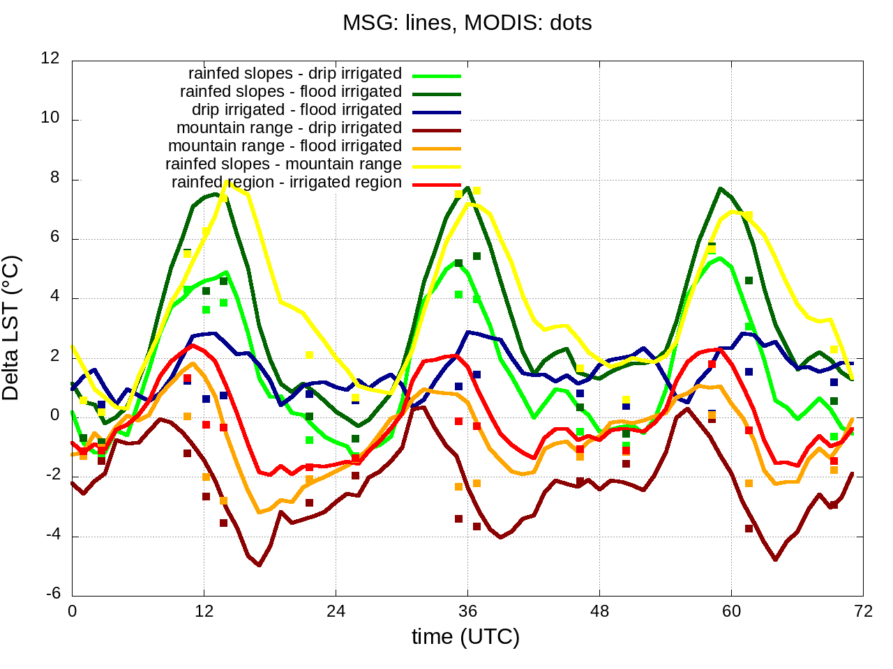
The temperature differences between these regions is evaluated from satellite-derived fields to check if models are able to reproduce it.
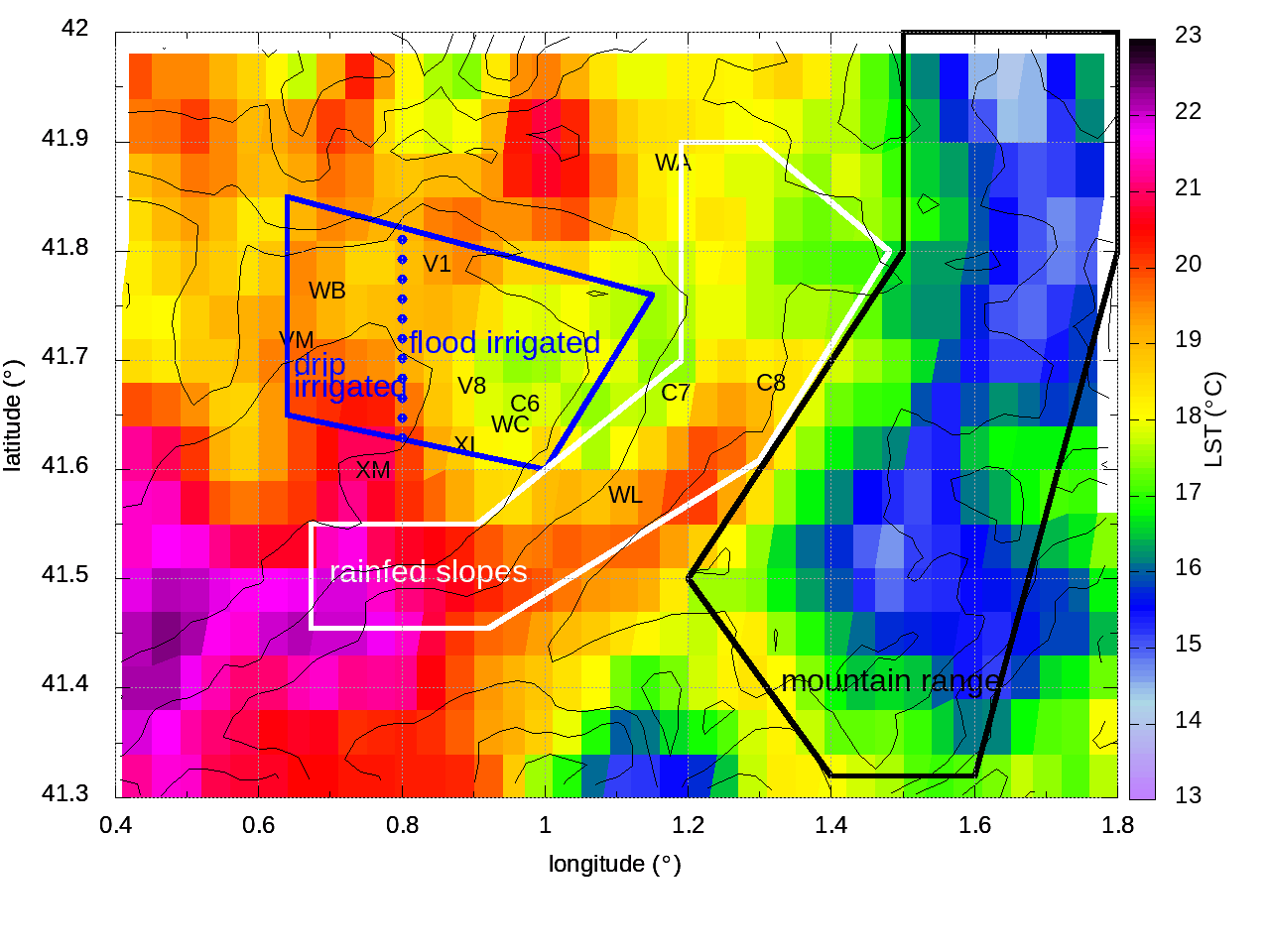
rainfed slopes (white polygon)
drip irrigated (WEST side, blue polygon)
flood irrigated (East side, blue polygon)
mountain range (black polygon)
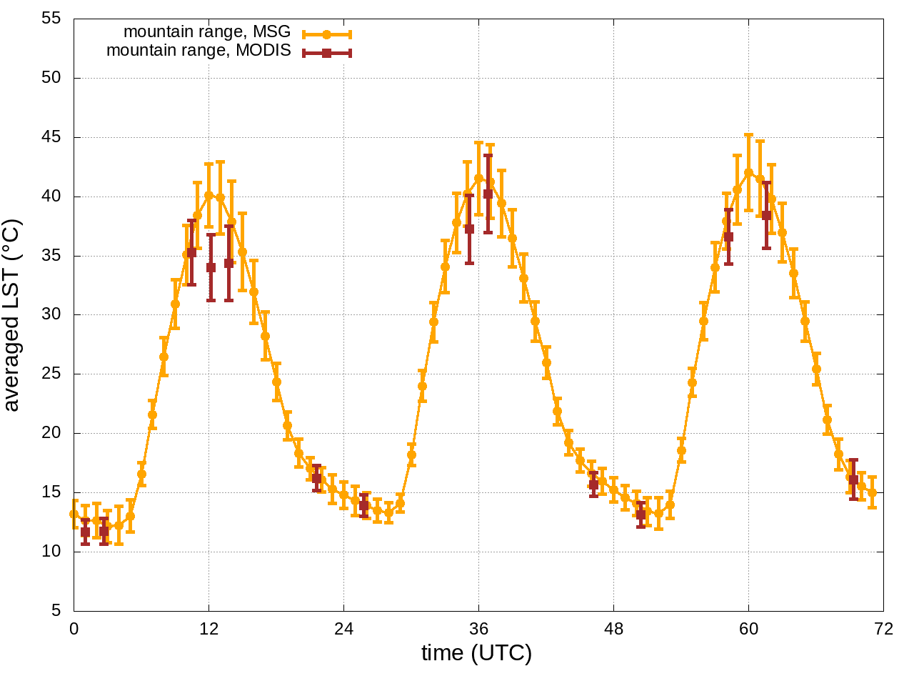
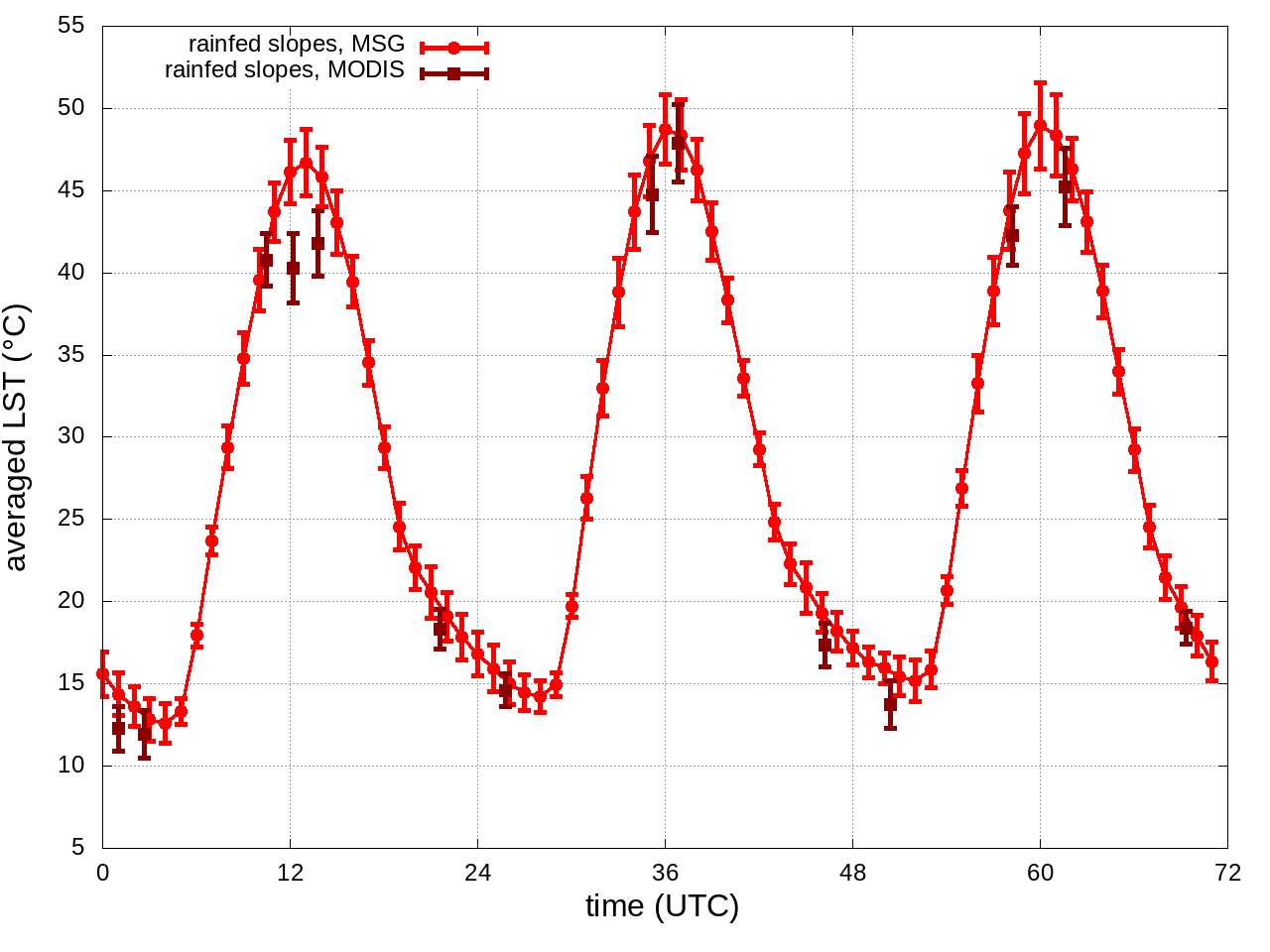
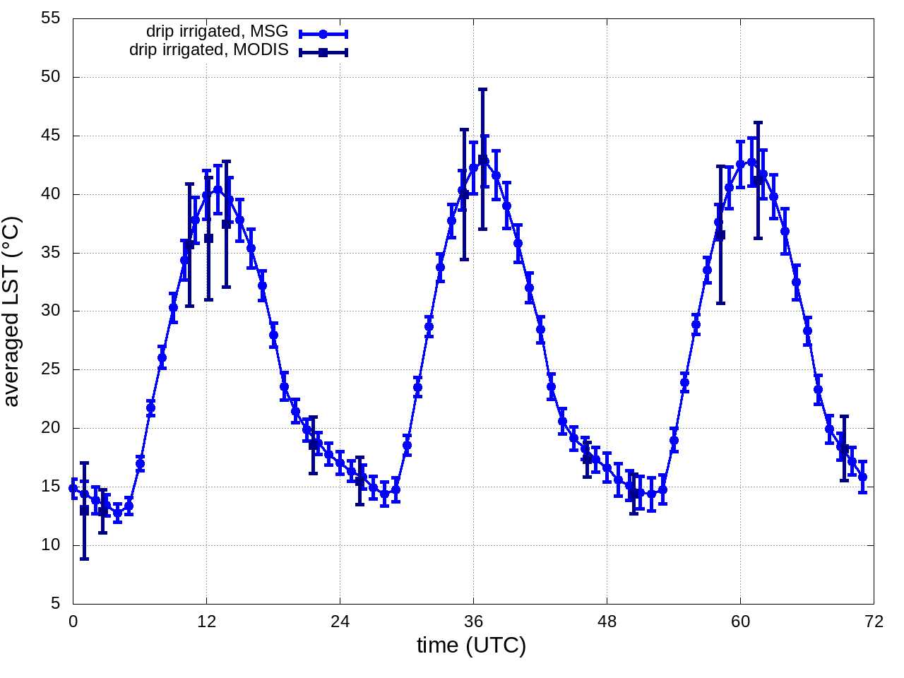
LST averaged over the 4 regions
LST averaged over the 2 regions: RAINFED REGION (rainfed slope + mountain range) and IRRIGATED REGION (drip and flood irrigated)
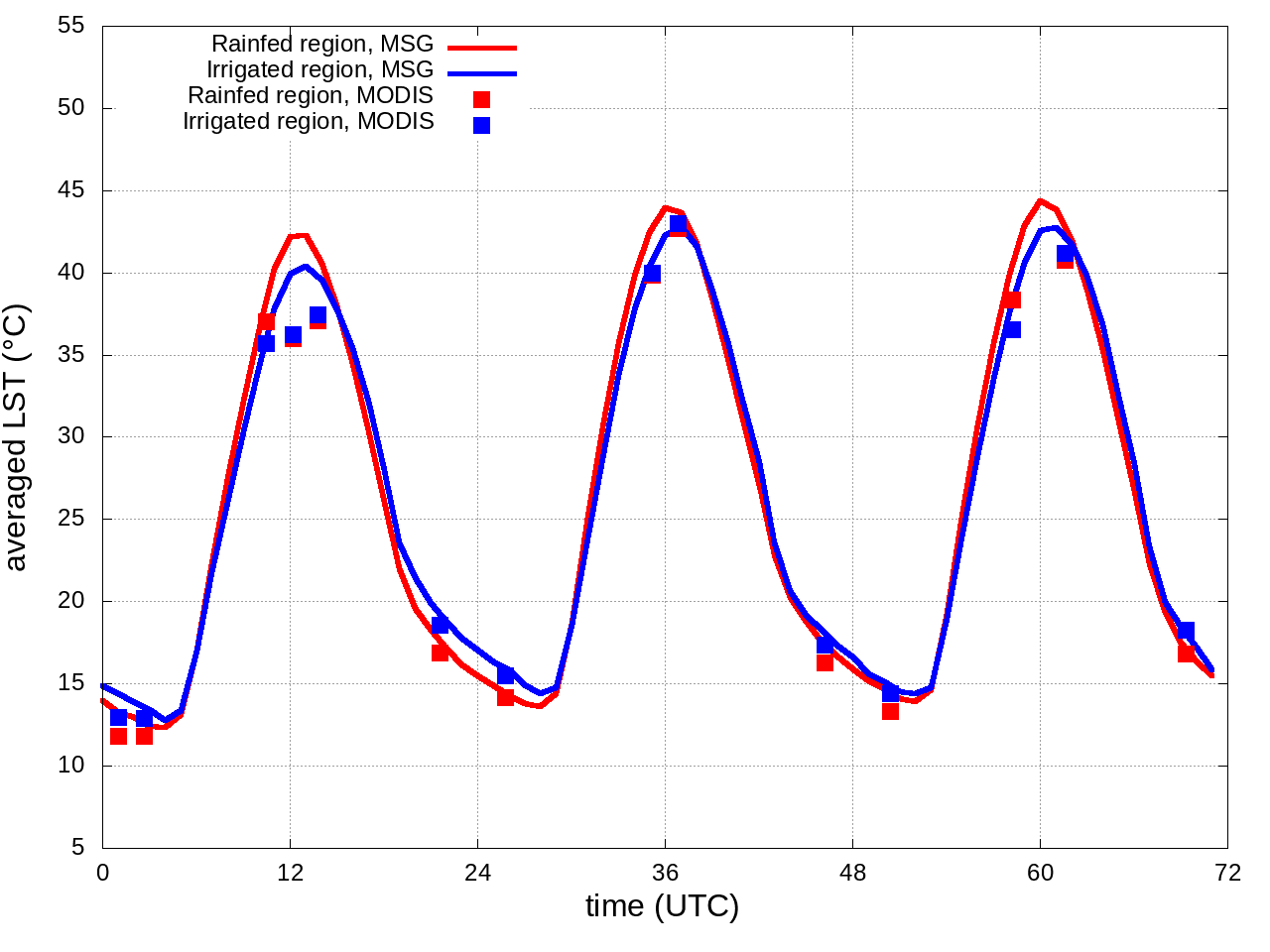
temperature differences between regions